| Mole Creek Caving Club | ||
|
~ about Mole
Creek page ~ |
||
| - home | aims & activities | about Mole Creek | conservation | Illuminations | contact us | photos | site map | links | about site - | ||
|
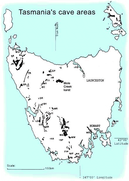
Mole Creek is a major limestone karst (cave area) in the central north of Tasmania (the southern island state of Australia). The map shows Mole Creek and other karst areas shaded in black. Mole Creek's limestone was formed about 500 m.y.a. (million years ago), metamorphosed and folded some 400 m.y.a., and since overlain, intruded, eroded, karstified and glaciated in a complex geohistory. Origins of the district's name date back to the white man's pioneering days of the late 1820s, but it is a matter of debate between the "mole" designation being due either to the discovery of local streams going underground (like a mole), or the locality being noted for its ample population of platypus (previously dubbed water moles). The karst area is under mixed land use and tenure - residential, grazing and dairy farming, private and state forestry, mining and small areas of reserves. There are serious cave conservation problems with inappropriate land uses and irresponsible activities. It is a cave area renown in Australia for its fine decorated caves. There are some 400 caves known, and more are being discovered each year. The caves are generally wet, typically with temperatures around 9°C, and feature active karst processes, growing speleothems and overlying and resident ecology. See our photos. It is noteworthy for interstate visitors that none of our 8 bat species live in caves of the island's karst areas. Want
to go caving at Mole Creek? contact us
to enquire. - back to aims and activities, home page - |

|
|